Objectives of Lecture
Digital Elevation Matrices (DEM)- a computer data structure not a depiction
Provides most numerical map reading access
Linked to field measurement (planetable) and photo-compilation (stereo reconstruction)
Contour interval, index contours, tinting...
USGS Brochure about topographic maps
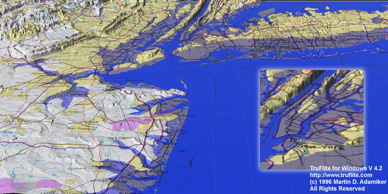
Fly-overs from Truflite.com; including such features as New York City under 20 feet of water, nice examples of drapped map features on hypsometric tints (Hawaii), and loads of MPEGS (fast line required).
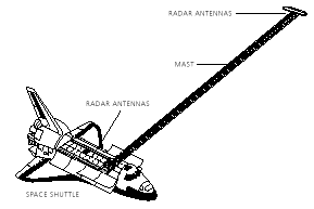
National Imagery and Mapping Agency's Shuttle Radar Topography Mission (SRTM) NASA has the most details: measure 85% of the earth using a 60 m boom from the shuttle cargo bay: Launch date 31 January 2000?
This mission will update the DTED data set used in many military applications, and provide higher resolution data for classified purposes (like cruise missiles) down to 30 m spacings (only publically available for USA...)
Version of 20 January 2000