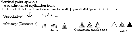
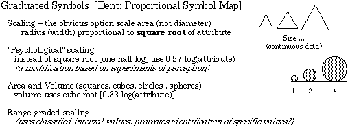
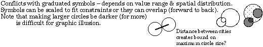
Treatment depends on level of measurement of attribute.
Resources for point symbols: National Imagery and Mapping Agency GeoSym project (soory not available online at the moment...)
Point symbols can be used for simplifying the spatial structure
to concentrate on the attribute information.
The scheme of Graphic Elements applies particularly neatly to
point symbols.
Attributes localized without internal dimension (points)
[space as control]
Treatment depends on level of measurement of attribute.
Resources for point symbols: National Imagery and Mapping Agency
GeoSym
project (soory not available online at the moment...)
Different use of point symbols. Attribute not directly at the
points shown.
See earlier lecture.