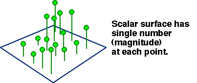
Surfaces are a thematic concept, assuming a single valued Z for
all points (x,y)
Two basic kinds: discontinuous.(prisms) and continuous
Discontinuous surfaces are implied by the thematic mapping
covered previously
Depicting terrain: shaded relief, classed elevation (filled contours), hachures, illuminated (Tanaka) contours, block diagrams, nominal symbols (hill, not hill)- Now, Virtual Reality, Augmented Reality.
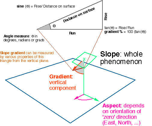
Height (Z), and horizontal location (x,y); one can be controlled (made regular), other measured
Regular height implies irregular horizontal location: CONTOURS
Contour Interval: vertical distance between contours
Contours can be directly measured on photogrammetry equipment: stereoplotter
Regular horizontal location implies iregular height: ELEVATION MATRIX (DEM)
also called Digital Terrain Model (DTM); USGS distributes DEMs.
Profiles: straight lines with regular sampling along them (Z measured)
turns into grid if profiles as dense as samples along them.
Stereoplotter can also track profiles, many DEMs are made by digitizing old contour maps, and interpolating.
Recognition of areas of shared slope and aspect, bounded by surface-specific features
Triangular facets, Triangular Irregular Network (TIN): spot heights connected by lines. An example of Palestine/Israel, another more evidently based on TIN, BIG TIN of Illinois.Resources: Wisconsin State Cartographer's Office description.