A revised definition of
Geographic Information Systems
For the purposes of Exploring GIS:
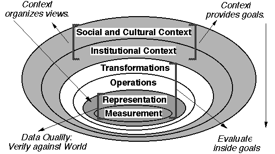
A Geographic Information System (GIS) can be defined as:
The organized activity by which people
- measure aspects of geographic phenomena and processes;
- represent these measurements, usually in the form of a computer
database, to emphasize spatial themes, entities, and relationships;
- operate upon these representations to produce more measurements
and to discover new relationships by integrating disparate sources; and
- transform these representations to conform to other frameworks
of entities and relationships.
These activities reflect the larger context (institutions and cultures)
in which these people carry out their work. In turn, the GIS may influence
these structures.
Index from Here: | Back to Exploring
GIS main index |
Version of 31 December 1996