Objectives:
< Additional Resources; illustrations linked, not included>
First: recognition that no one map layer is enough to make a decision. Environment is full of interactions. No one science measures exactly all the relevant information as one single value. (Still it occurs that people fail to get this far...)
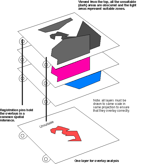
McHarg's Design with Nature (1969) proclaimed that environmental
design required multiple factors and overlay, though the method
is a bit hazy...
<Illustration of McHarg's manual overlay technique applied to site suitability>
Many environmental regulations imply overlay logic (examples)
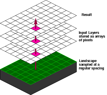
Raster implementation is relatively easy (the integration is already done)
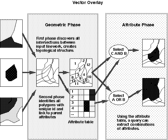
Vector Overlay
involves a geometric discovery of intersections - creates a new
representation
Actually a form of spatial JOIN where the "key" is sharing position (containership)
All served by one engine that performs "Planar
Enforcement" on the geometry
Category assumed to apply even over whole polygon/cell...
Combination of attributes requires agreement of the various parties...
a whole social science issue (see next lecture)
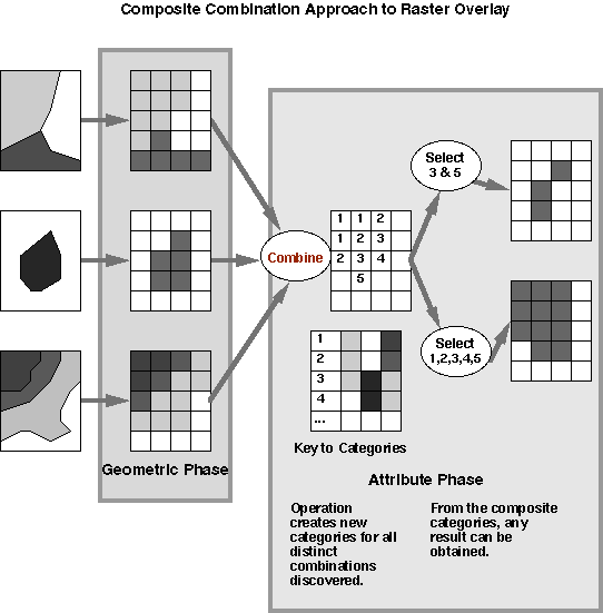
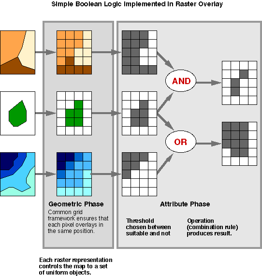
Complete combination approach: intersect everything before any analysis
Logic applied: set
operations {AND, OR, NOT} "Boolean
logic"
Some operations can produce results by enumerating all the
combinations obtained (Change
analysis and error detection, for example)