Objectives of Lecture:
Basic structure set out in Course Policies; more in Project description
Now is the time to create a team and pick a topic. Yes this involves thinking about data sources available, but there is no time like the present to get started...
There are a lot of ways to keep track of what operations you have performed/ will be performing. Any technique that works for you and your team is probably good enough. For the purposes of this class, we want to help you work with diagrams beginning with Exercise 3.
You can get more creative in terms of layout... but the content is what will save you effort.
Background, Geometric calculations; Attribute Rules for Combination; Resources about overlay
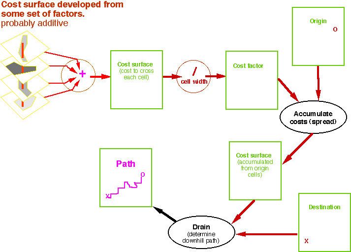
[Examples presented from overheads]
Blast from the past! Running Map II on a Mac IIci... Map II is a relative (like a long lost uncle?) of Sptail Analyst; They are all progeny of MAP package.
Balloon launch cannot be within 1000 feet of electric power transmission lines.
Balloon launch cannot be within a wetland, river or lake.
Balloon launch cannot have tree cover or houses.
Balloon launch must be flat.
Large: within 300 feet of electric power transmission lines, some within 1000
Large: lake, river
Some: wetlands
Large: Old growth, mature trees, urban
Some: shrubs, etc.
No: farm fields, unmowed grass, etc.
Slope classed 0-5%, 5-10%, 10% and up.
Distance electric power transmission lines.
Wetland, river or lake.
Tree cover or houses.
% slope