Objectives of lecture:
Evaluation compares results to intended goals.
Often, what is measured is the
component of utmost interest. (Since the choices to control reduce
variability, this makes sense.)
Data Quality concerns evaluate the technical
result of the system from measurement
through representation, operations and
all transformations.
It is always possible to do better on
data quality... Projects must be done with incomplete data, inadequate
data.
BIG QUESTION: When would the flaws and inadequacies in the data get SO bad that you would have to tell them the project is not feasible?
A manager of a GIS will be judged on other criteria than simply the data quality.
Duplication, a major sign of misallocation?
Finland: Joint Use report, has material on allocation, compatibility, and inter-operability
Interoperability, a continuing hot-topic
Choices about measurement for geographic phenomena relate to
resolution and accuracy, basic concerns of data quality. They
also raise questions of the choices involved in implementing a
design.
A continuum of approaches:
Parametric extreme
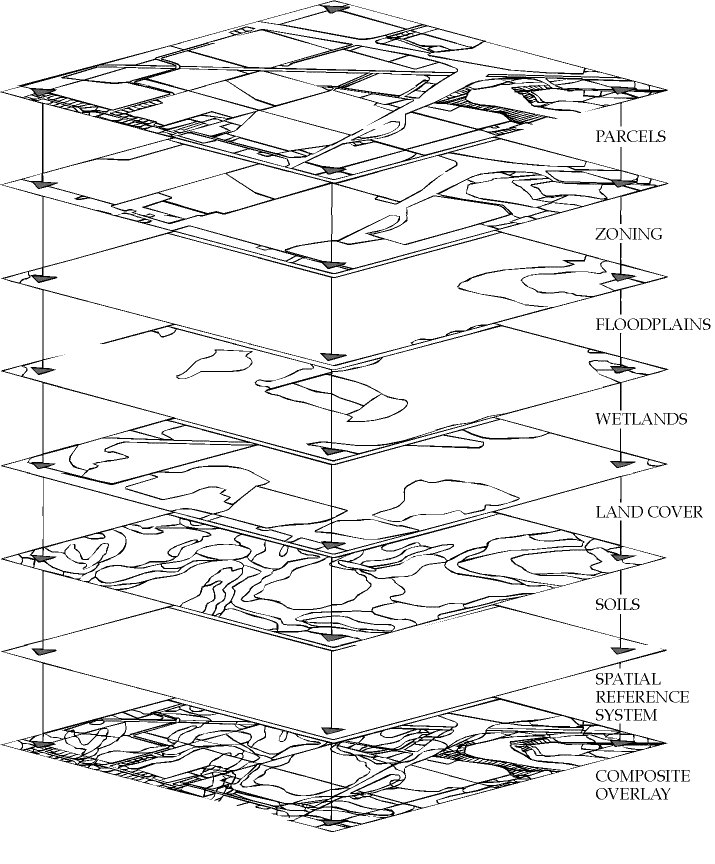
Each attribute measured separately. Measurement framework chosen for that attribute separately. Multipurpose in the sense that the measurement be used each time that particular parameter is needed. The "layer cake" diagram shows this conceptually, but real layer cakes are NOT as extreme, because each map may have a lot of attributes attached.
Integrated Survey
One map as combined result of all relevant experts. Linked to a purpose that must be known before the survey starts. Origins in Australian 'land systems' regionalizations; adopted by UN Food and Agricultural Organization (1976) for rural development work. [an example]
Intermediary possibilities
Almost all projects fall somewhere along this continuum. Indirect measurement (assigning continuous attributes to categories on the map) still quite common. Soil maps and forest inventories often fall closer to the 'integrated' end. The tighter the list of attributes the more 'parametric' it is.
The tradeoffs involve: